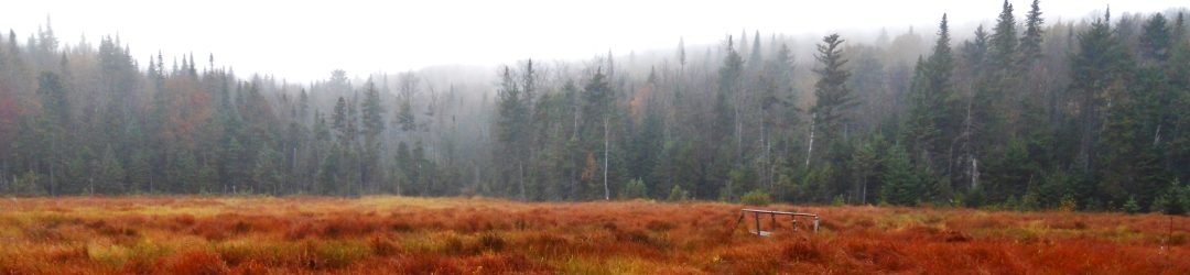
NPT Fall Stewardship Hike: Tarbell Hill Rd (Long Lake) to Rodney’s Lean-to October 17-18, 2015
Trip Leader: Bill Celentano
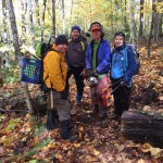
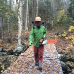
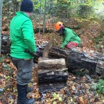
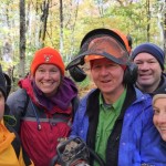
On the Weekend of October 17-18 The NPT Chapter held a Stewardship outing led by Trip Leader Bill Celentano and a group of 5 Diana, Will, Jim, Nancy, and Steve. The group met up at Catlin bay lean-to early Saturday morning set up Camp and set out on a 5.5 mile one way hike to Rodney’s Lean-to. The group carried an assortment of tools that included a chainsaw, loppers and clippers. The weather was cold around 30 degrees with blowing snow all day. This group of go getters worked our way slowly out to Rodney’s point over the course of about 5 hours doing trail clean up the entire way clearing roughly 35 large blow downs. Along the way we stopped at Kelly’s lean-to for lunch where we met up with some hunters who were there for the week deer and bear hunting. Once at Rodney’s point we as a group went down and cleaned up the 2 lean-tos at Rodney’s while another group cleared a couple of large blow downs in that area. Upon completion we hiked back to Kelly’s lean-to and eventually back to Catlin Bay. Along the way the idea of taking down camp and sleeping at a chapter members nearby camp was offered as an option. We held a vote and quickly determined that that was the way to go. The 6 of us broke down camp and hiked out that evening with plans to return the next morning and finish the trail maintenance that was left between Catlin Bay and Tarbell Hill rd.
Once at the camp for the night we enjoyed a steak dinner and some festivities around a fire and enjoyed a good night sleep in a warm camp. The Chapter would like to thank the camp owner for their generosity. It made for a very enjoyable time filled with good food, drink and good stories.
The next morning after a good night rest and a good breakfast we returned to Catlin bay for the conclusion of trail clean up. We spent the next 2 hours working on the 1.1 mile section of trail back to Tarbell Hill rd. I want to thank all participants of this outing for all the hard work you did as well as making it a very enjoyable weekend.
We had 3 members earn their NPT Stewardship patch this weekend for completing their third outing. Thank you to the three of you for your continued support.
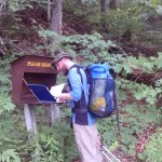
NPT Section Hike: Benson Road to Northville September 27, 2015
Trip Leader: Diana Niland
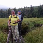
On September 27th, ten participants enjoyed a 12 mile hike on the newly opened section of trail running from the Northville arch to Benson Road. On this mild and sunny day, we walked a steady pace, enjoying the woods walk that eliminated about 5.5 miles of road walking. This new segment only required about 3.5 miles on the road, and the road walk is now a safer and more pleasant walk, including a sidewalk for about half of the distance.
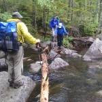
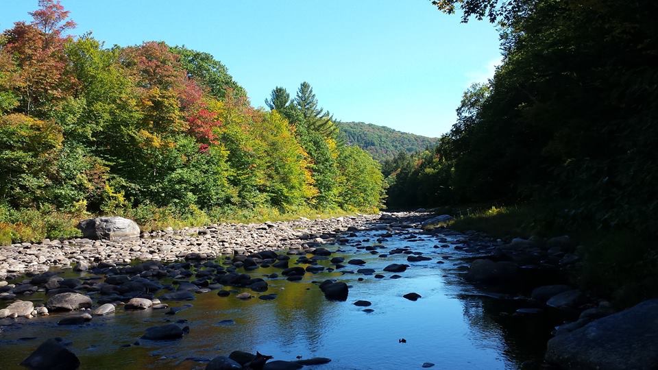
We started off from Benson Road and meandered along the well-marked trail. With some small climbs this hike was mildly strenuous, and in several spots included switchbacks that made the grades easier. There are several interesting highlights on this trip, including some several glacial erratics, and of course a ford of West Stony Creek. This will eventually include a bridge and should be considered a hazard in spring runoff and in heavy rains, but on our adventure it was an 80 foot rock hop. Much of the season it would be no more than a wide but minor ford, but anyone hiking this stretch in high waters should consider an alternate route for safety.
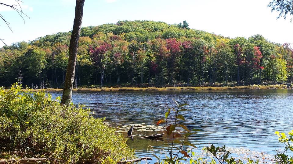
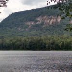
We stopped at a picturesque outcropping at Mud Lake for lunch where we relaxed for a little while. On our way out we avoided a spot where a hornets’ nest was recently reported, but otherwise had a pleasant woods walk out to the road. This was a nice stretch and the section between Collins Gifford Valley Road and Mud Lake would make for a pleasant walk for many beginners or those who want a short out and back hike or nice picnic spot.
The road walk began on a gravel road with one final mild climb for the day. We had to be alert at the Route 30 crossing, but otherwise felt safe and found the signage clear on the road walk. Eventually, we proceeded across the bridge into Northville and ended our hike at the beautiful arch in Waterfront, the true southern terminus of the Northville-Placid Trail.
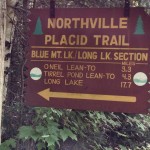
Wakely Dam – Long Lake July 24-26, 2015

Trip Leader: Diana Niland
After spotting cars on the north end of the hike the group of four of us met at the day use area of
Wakely Dam where we did last gear checks and introductions. With a breakdown of two women (Diana and Michelle) and two men (Bill and Mike), all in the same approximate age bracket, it looked like a fun group, and indeed it was!
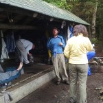
After doing the road walk we welcomed the turn into the woods onto the newer, re-routed trail, saving us several miles of walking on pavement to the former Macaluso property. We carried plenty of water as this stretch is limited (by NPT standards). After some short breaks we made our way to Stephen’s Pond lean-to, where we set up tents and made a small fire to keep the bugs down. After a while we were joined by several thru-hikers and long section hikers and enjoyed a relaxed evening of sharing stories and information.
With a short day planned for Saturday due to the tricky logistics of group camping being limited leading up the Blue Mountain shoulder, we agreed to take our time, enjoy coffee and head out of camp at a relaxed pace. Once we arrived at Lake Durant Campgroud we ran into a friendly face in fellow chapter member Jim, who was camping with his family. The group enjoyed real bathrooms and running water and everyone at least got to wash faces and hands! After a snack we headed to our planned destination, O’Neill lean-to, and arrived at lunch time. The group had already been discussing hiking to the unofficial camping spot at the Salmon River, but we knew it would be tight quarters for four and that it could be occupied and that we would have limited options if it was. However, with our lunchtime arrival at O’Neill, everyone was game to go for the Salmon River spot.
We hiked on to the Salmon River sight and found it unoccupied, so we set up camp. Having just been reminded of the potential impact on the environment, we discussed Leave No Trace and, in particular, we discussed disposal of waste considering we were close to a water source. Around dinner time, a couple who had hike an extremely long day hiked in, so we offered to make them room. They joined us and although they were too tired to interact much, we all had a really nice time at this locale and it made for a more logical distance for the second and third hiking days.
On Sunday morning, after an all-night deluge, we packed up camp and were hiking by 7.30. A slow and steady but pleasant hike over the Blue Mountain shoulder was fun and we enjoyed the meandering of the trail through a variety of settings on our final day. After the final careful walking across the long section of slippery bog bridges, we arrived at the Long Lake trailhead having had a fun and successful hike in mostly good weather. The group felt satisfied about our hike and it was a good natured and compatible crew throughout the trip.
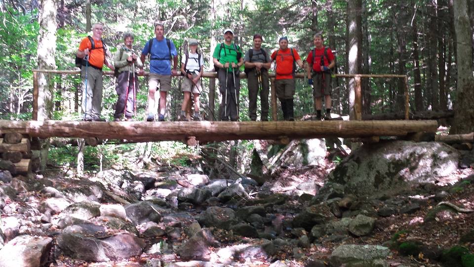
Wakely Dam to Piseco – June 27-30, 2015
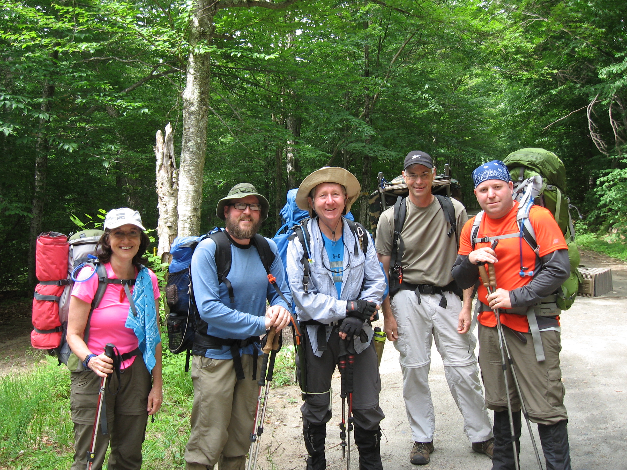
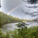
Photo by Bruce Germain
Trip Leader: Russ Byer
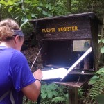
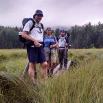
We left 3 cars at the DOT and drove 2 to Wakely Dam. We signed in at the register and headed down the trail. The weather was perfect for hiking but we knew this wasn’t to last. The first night was to be at Colvin Brook, but since this required crossing the Cedar River on rocks, it was decided not to risk having to cross again with high water from the impending storm. This would lengthen the first day by 3 miles, but shorten the second day by the same. The group stayed together and hiked at a decent pace.
We arrived at Cedars #1 well in front of the rain. Setup and wood gathering were the first order. Fire and food were soon being enjoyed, and then the rains came. The storm continued through the night.
In the AM, the rain came and went. Since we had hiked extra yesterday, we were in no rush to get moving. At a point where the rain seemed to break, we headed down the trail. The NPT is typically wet, and the West Canadas are often the wettest section. Coupled with a storm for the last 12 hours, the trail was a mess. We stopped at Cedars #2 for a quick break, paused at the junction to Cedars #3. Even though the trail was sloppy I was enjoying the hike. The others seemed to be too, as least there wasn’t any grumblings that I could hear. We stopped for a quick lunch. Rains came but nothing like the previous night. The trail changed a lot through this section.
At one point the remnant telephone pole was noticed. This was from when the ranger station used to exist. Was odd seeing it in the woods laying among the fallen spruce trees. Odder still was the ladder leaning up against the back of a tree a few feet off trail earlier in the day. The beaver activity at the reroute along with the recent rains had made a big mess of the trail. Even though our feet were wet, we tried to not step even deeper into the muck. We took a break after the really wet reroute before the fireplace clearing. The field was tall with weeds and they were soaked. We signed in at the register and a few contemplated moving closer to the fireplace for photos, but opted against it. We were close to camp and I suppose we all wanted to take off our wet socks. A few last photos and back on to the trail. A slip on a wet rock is all it takes for an easy walk to become something else. 16 miles from either end of the trail doesn’t leave many options. A final option is the PLB. For the next few hours at least, Rest, “ice” it with the lake, compression and elevation.
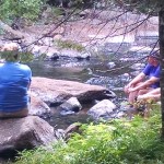
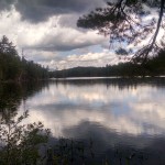
We didn’t dawdle this morning even though the view was amazing. As the sun came up and lit the far side of the lake, the morning fog was melted away. Then a rainbow appeared. Cameras came out and some good shots were taken. At present one of them is the now the header for the NPTrail.org page. The swelling on the turned ankle had gone down some, and not wanting to slow everyone down, the group was split into the injured party and the trip leader, another leader took the rest of the group. Pack weight was redistributed away from the injured. Pre-planned rendezvous points were scheduled for safety and re-assessment.
The cold streams felt good on our feet as it was getting warmer. The mosquitoes also began to emerge to our dismay. Arrival at Fall Stream campsite at 6:27. The first group had already set up, started a fire and gathered some wood. They were 45 minutes ahead of us, maybe more. With everyone set up, more wood was collected. Dinner and conversation ensued. This campsite oddly gets 4G service, updated with the news that the other convict had been shot and captured. These convicts had been national news for the last few weeks. The trail is so separate from the rest of the world. Simpler yet complex in its own way. It becomes a new reality and assimilates those who hike it.
From here out the trail is relatively flat with one significant downhill. Worries about the wetness and potential falling on this section. At the end of the trail, at least one would need to walk to the cars, it ended up being three, while the other three remained at the bridge for the rides.